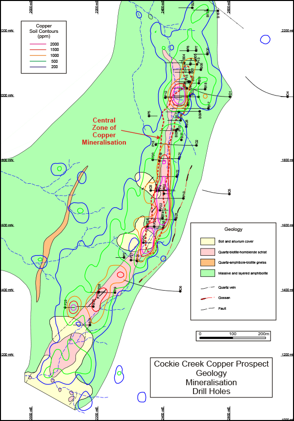
At Cockie Creek, disseminated copper mineralisation with some gold and molybdenum is associated with a quartz-biotite-hornblende schist unit enclosed within a metamorphosed basic volcanics sequence. The quartz-biotite-hornblende schist unit is interpreted as a metamorphosed altered tonalite intrusive unit. The copper mineralisation, with a true width of up to 60 metres, extends over 1.2 kilometres and dips grid easterly at -80°.
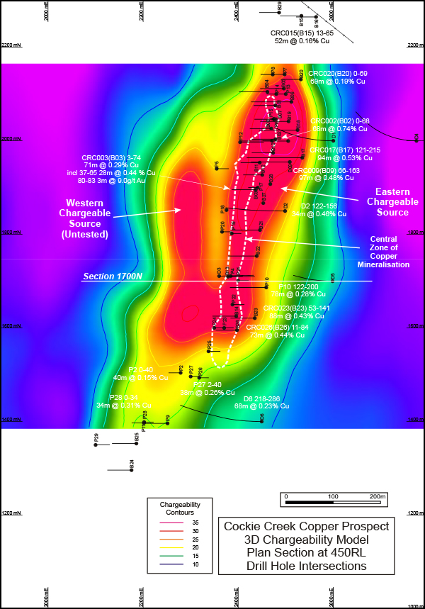
Historical drilling comprises a total of 63 drill holes for 6,638 metres. Selected drill hole intersections are shown below.
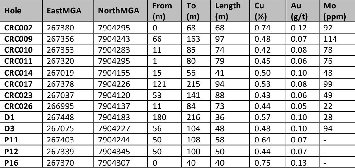
Also of interest is an intersection of 3m @ 9.0 g/t Au between 80 and 83m in drill hole CRC003 (B03) drilled through the central zone of copper mineralisation.
JORC 2004 Inferred Mineral Resource Estimate
A resource estimation in accordance with the 2004 JORC Code and based on historical drilling was developed for global inferred resources down to a RL of 300 metres (approximately 250m depth):
Insufficient assay data exists for reliable estimations of gold and molybdenum to be made.
Geophysical modelling
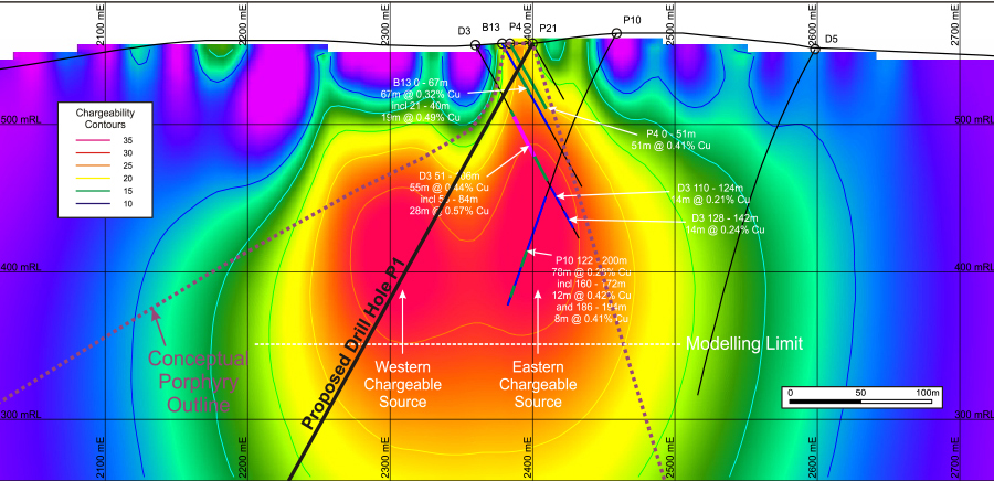
Superior completed three-dimensional computer modelling of existing IP geophysical survey data. The modelling produced at least two pronounced chargeable sources located beneath shallower disseminated copper mineralisation and also indicated potential for the existence of a large porphyry copper mineralised system beneath the near-surface mineralisation.
As a result, the modelling has opened up the potential of the Cockie Creek area to host a significant porphyry copper deposit.
